India Transitions Its Dual-Band Synthetic Aperture Radar (SAR) Technology from Laboratory to Policy Implementation, as Per NISAR
The NASA-ISRO Synthetic Aperture Radar (NISAR) mission, scheduled to launch on July 30, 2025, from Sriharikota, promises to become a game-changer in Earth-system data collection, aligning with India's vision for a self-reliant nation by 2047 (Viksit Bharat 2047) and global climate stewardship.
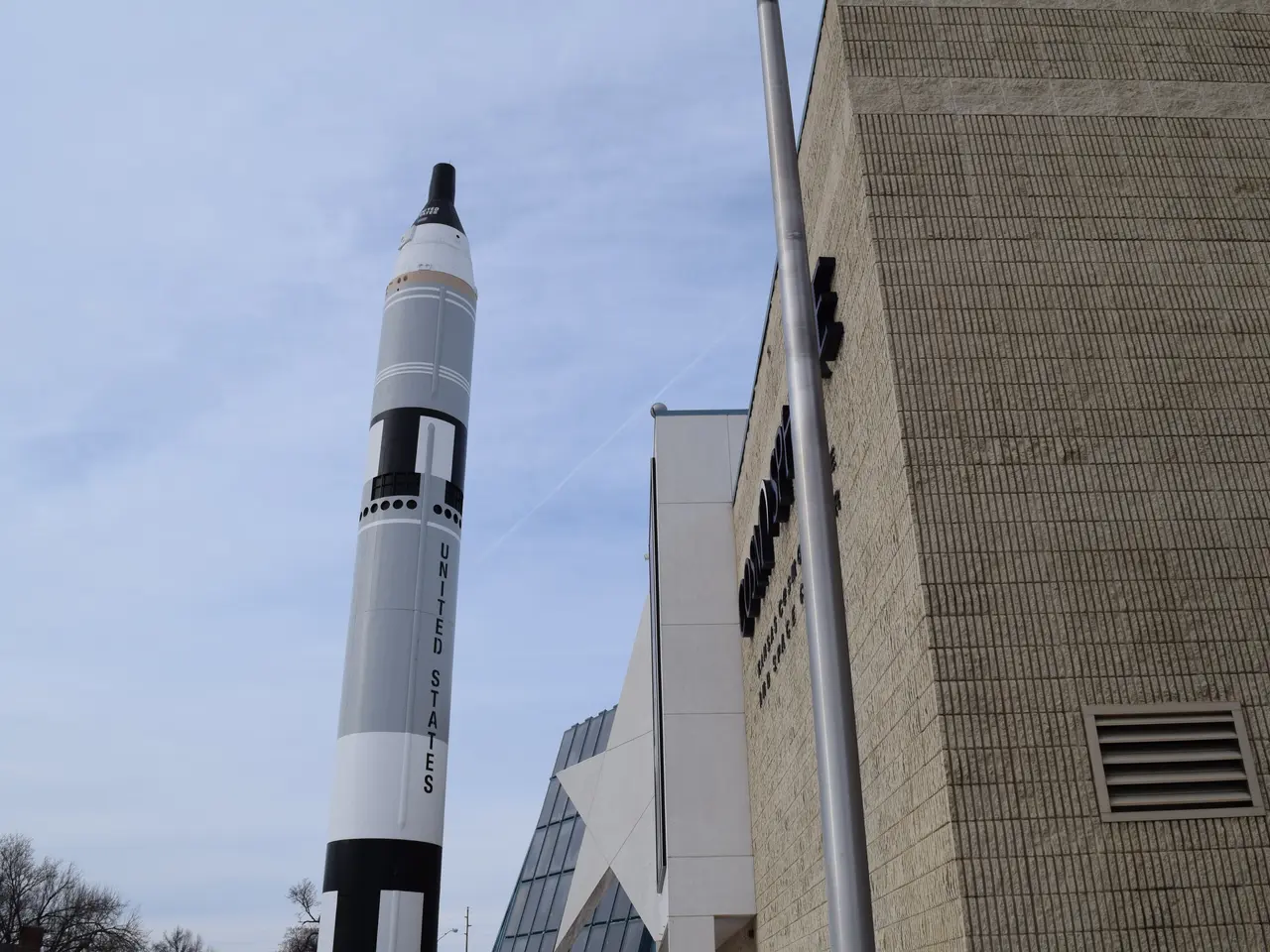
This groundbreaking mission features a unique dual-band Synthetic Aperture Radar system, operating at L-band (25 cm wavelength) and S-band (10 cm wavelength). This dual-band capability, a first in the history of space exploration, enhances the mission's ability to capture detailed microwave imaging across a wide range of surface characteristics such as moisture, surface roughness, and motion.
A key innovation is the application of the novel SweepSAR technique, which provides high-resolution imagery with a large swath, allowing detailed global imaging of land, ice, islands, sea ice, and selected ocean regions every 12 days. The 12-meter (39-foot) radar antenna reflector deployed in orbit directs and receives microwave signals from both radars, enabling interferometric and fully polarimetric data acquisition to analyse changes in Earth's surfaces comprehensively.
The mission's large data generation capacity, producing around 80 terabytes per day, requires advanced high-speed data handling, storage (Solid-State Recorder), and downlink systems developed by both ISRO and NASA. The collaboration merges ISRO's expertise in S-band radar systems and spacecraft infrastructure with NASA’s L-band radar technology and data processing capabilities.
NISAR's high-frequency revisit (12 days) and ability to operate through all weather conditions and during day or night enhance its monitoring capabilities for ecosystems, ice, land deformation, and ocean processes. Its open-data policy delivers data within hours, directly advancing Sustainable Development Goals 2, 11, 13 & 15.
India is also planning a nationwide Corner Reflector Grid to auto-calibrate phase data within six months via IIT-ISRO MoUs. The Indian policy ecosystem includes the National Geospatial Policy 2022, PM Gati-Shakti, Indian Space Policy 2023, and IN-SPACe rules, enabling commercialization of value-added SAR analytics.
NISAR's dual-band SweepSAR sets it apart as a first-mover in the high-end SAR value chain. A cloud-native Data Lake is being fast-tracked for NRSC, aiming to permit Jupyter-based analytics pipelines for start-ups. A two-semester "Applied InSAR" elective is proposed in AICTE curricula to address the SAR literacy gap.
The benefits of NISAR's data will be felt in various domains such as solid earth, ecosystems & agriculture, cryosphere, coastal & ocean, disaster response, and additional uses like monitoring tilt in dams and methane leak detection. The mission's cost of US $1.5 billion makes it the costliest to date, but the assured radar data for India, and the U.S.'s shared costs and orbits otherwise inaccessible due to ITAR regimes, justify the investment.
GSLV-Mk-II reliability is being addressed through an FMECA-led redesign of cryogenic stage valves and simulating 1,000 duty cycles before the next Mk-II flight. A unified SAR Tasking Cell is being integrated into NDMA's Decision Support System, pre-defining "hurricane macros" for auto-imaging. A Tiered-Latency Policy is being considered, releasing civilian tiles in near-real-time while delaying sensitive border strips by 72 hours.
In summary, NISAR's pioneering innovations are its co-developed dual-band SAR payload combining L-band and S-band radars, the advanced SweepSAR imaging technique, a large deployable antenna, and the high data throughput and processing infrastructure enabling unprecedented Earth surface monitoring. The mission is poised to revolutionise Earth-system data collection and analysis, contributing significantly to India's ambitious goals for self-reliance and global climate stewardship.
- The NISAR mission, employing a dual-band Synthetic Aperture Radar system, assists in the collection of Earth-system data, aligning with India's vision for a self-reliant nation (Viksit Bharat 2047) and global climate stewardship.
- The mission's advanced technology, including the application of the SweepSAR technique, enhances its ability to capture detailed microwave imaging for various surface characteristics, such as those found in environmental-science studies.
- To manage the mission's large data generation capacity, both ISRO and NASA have developed high-speed data handling, storage, and downlink systems, demonstrating the collaboration's proficiency in finance and technology.
- By providing open-data policy and high-frequency revisit capabilities, NISAR contributes significantly to Sustainable Development Goals, particularly those related to education-and-self-development, general-news, and science, including space-and-astronomy and environmental-science.


%20Technology%20from%20Laboratory%20to%20Policy%20Implementation%2C%20as%20Per%20NISAR)